This week we have studies on brook trouts, Antarctic Peninsula ice surface, cloud fraction, climate variables, wind, North Atlantic, heat waves, methane, China, precipitation, urban heat island, heat stress, Montana lakes, and sea ice.
Abstract: "Redd (nest) surveys for resident brook trout (Salvelinus fontinalis) were conducted annually in a mountain lake in northern New York for eleven years with multiple surveys conducted during the spawning season in eight of those years. Repeated surveys throughout the spawning season allowed us to fit an individually-based parametric model and estimate the day of year on which spawning was initiated, reached its midpoint, and ended during each year. Spawning phenology was then assessed relative to (1) mean of maximum daily air temperature and (2) mean of maximum daily water temperature at the lake bottom during summer in each year using a linear model. Elevated temperatures in summer were correlated with a delay in spawning and a reduction in the total number of redds constructed. Increasing the summer mean of maximum daily air temperatures by one degree C delayed spawning by approximately one week and decreased the total number of redds constructed by nearly 65. Lake spawning brook trout select redd sites based on the presence of discharging groundwater that is relatively constant in temperature within and across years, leading to relatively consistent egg incubation times. Therefore, delayed spawning is likely to delay fry emergence, which could influence emergence synchrony with prey items. This work highlights non-lethal and sub-lethal effects of elevated summer temperatures on native resident salmonids in aquatic environments with limited thermal refugia."
Citation: Dana R. Warren, Jason M. Robinson, Daniel C. Josephson, Daniel R. Sheldon, Clifford E. Kraft, Global Change Biology, DOI: 10.1111/j.1365-2486.2012.02670.x.
Abstract: "We use data acquired between 1978 and 2008 by four satellite radar altimeter missions (Seasat, ERS-1, ERS-2 and Envisat) to determine multi-decadal elevation change rates (dhi/dt) for six major Antarctic Peninsula (AP) ice shelves. In areas covered by the Seasat orbit (to 72.16oS), regionally-averaged 30-year trends were negative (surface lowering), with rates between -0.03 and -0.16 m a-1. Surface lowering preceded the start of near-continuous radar altimeter operations that began with ERS-1 in 1992. The average rate of lowering for the first 14 years of the period was typically smaller than the 30-year average; the exception was the southern Wilkins Ice Shelf, which experienced negligible lowering between 2000 and 2008, when a series of large calving events began. Analyses of the continuous ERS/Envisat time series (to 81.5o) for 1992-2008 reveal a period of strong negative dhi/dt on most ice shelves between 1992 and 1995. Based on prior studies of regional atmospheric and oceanic conditions, we hypothesize that the observed elevation changes on Larsen C Ice Shelf are driven primarily by firn compaction while the western AP ice shelves are responding to changes in both surface mass balance and basal melt rates. Our time series also show that large changes in dhi/dt can occur on interannual time scales, reinforcing the importance of long time series altimetry to separate long-term trends associated with climate change from interannual to interdecadal natural variability."
Citation: Fricker, H. A. and L. Padman (2011), Thirty years of elevation change on Antarctic Peninsula ice shelves from multi-mission satellite radar altimetry, J. Geophys. Res., doi:10.1029/2011JC007126, in press.
Evaluation of cloud fraction and its radiative effect simulated by IPCC AR4 global models against ARM surface observations - Qian et al. (2012) [FULL TEXT]
Abstract: "Cloud Fraction (CF) is the dominant modulator of radiative fluxes. In this study, we evaluate CF simulated in the IPCC AR4 GCMs against ARM long-term ground-based measurements, with a focus on the vertical structure, total amount of cloud and its effect on cloud shortwave transmissivity. Comparisons are performed for three climate regimes as represented by the Department of Energy Atmospheric Radiation Measurement (ARM) sites: Southern Great Plains (SGP), Manus, Papua New Guinea and North Slope of Alaska (NSA). Our intercomparisons of three independent measurements of CF or sky-cover reveal that the relative differences are usually less than 10% (5%) for multi-year monthly (annual) mean values, while daily differences are quite significant. The total sky imager (TSI) produces smaller total cloud fraction (TCF) compared to a radar/lidar dataset for highly cloudy days (CF > 0.8), but produces a larger TCF value than the radar/lidar for less cloudy conditions (CF < 0.3). The compensating errors in lower and higher CF days result in small biases of TCF between the vertically pointing radar/lidar dataset and the hemispheric TSI measurements as multi-year data is averaged. The unique radar/lidar CF measurements enable us to evaluate seasonal variation of cloud vertical structures in the GCMs. Both inter-model deviation and model bias against observation are investigated in this study. Another unique aspect of this study is that we use simultaneous measurements of CF and surface radiative fluxes to diagnose potential discrepancies among the GCMs in representing other cloud optical properties than TCF. The results show that the model-observation and inter-model deviations have similar magnitudes for the TCF and the normalized cloud effect, and these deviations are larger than those in surface downward solar radiation and cloud transmissivity. This implies that other dimensions of cloud in addition to cloud amount, such as cloud optical thickness and/or cloud height, have a similar magnitude of disparity as TCF within the GCMs, and suggests that the better agreement among GCMs in solar radiative fluxes could be a result of compensating effects from errors in cloud vertical structure, overlap assumption, cloud optical depth and/or cloud fraction. The internal variability of CF simulated in ensemble runs with the same model is minimal. Similar deviation patterns between inter-model and model-measurement comparisons suggest that the climate models tend to generate larger biases against observations for those variables with larger inter-model deviation. The GCM performance in simulating the probability distribution, transmissivity and vertical profiles of cloud are comprehensively evaluated over the three ARM sites. The GCMs perform better at SGP than at the other two sites in simulating the seasonal variation and probability distribution of TCF. However, the models remarkably underpredict the TCF at SGP and cloud transmissivity is less susceptible to the change of TCF than observed. In the tropics, most of the GCMs tend to underpredict CF and fail to capture the seasonal variation of CF at middle and low levels. The high-level CF is much larger in the GCMs than the observations and the inter-model variability of CF also reaches a maximum at high levels in the tropics, indicating discrepancies in the representation of ice cloud associated with convection in the models. While the GCMs generally capture the maximum CF in the boundary layer and vertical variability, the inter-model deviation is largest near the surface over the Arctic."
Citation: Qian, Y., Long, C. N., Wang, H., Comstock, J. M., McFarlane, S. A., and Xie, S.: Evaluation of cloud fraction and its radiative effect simulated by IPCC AR4 global models against ARM surface observations, Atmos. Chem. Phys., 12, 1785-1810, doi:10.5194/acp-12-1785-2012, 2012.
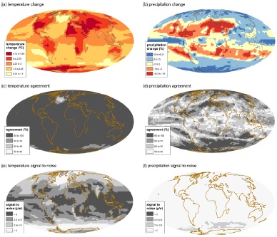
Mapping the climate: guidance on appropriate techniques to map climate variables and their uncertainty - Kaye et al. (2012) [FULL TEXT]
Abstract: "Maps are a crucial asset in communicating climate science to a diverse audience, and there is a wealth of software available to analyse and visualise climate information. However, this availability makes it easy to create poor maps as users often lack an underlying cartographic knowledge. Unlike traditional cartography, where many known standards allow maps to be interpreted easily, there is no standard mapping approach used to represent uncertainty (in climate or other information). Consequently, a wide range of techniques have been applied for this purpose, and users may spend unnecessary time trying to understand the mapping approach rather than interpreting the information presented. Furthermore, communicating and visualising uncertainties in climate data and climate change projections, using for example ensemble based approaches, presents additional challenges for mapping that require careful consideration. The aim of this paper is to provide background information and guidance on suitable techniques for mapping climate variables, including uncertainty. We assess a range of existing and novel techniques for mapping variables and uncertainties, comparing "intrinsic" approaches that use colour in much the same way as conventional thematic maps with "extrinsic" approaches that incorporate additional geometry such as points or features. Using cartographic knowledge and lessons learned from mapping in different disciplines we propose the following 6 general mapping guidelines to develop a suitable mapping technique that represents both magnitude and uncertainty in climate data: – use a sensible sequential or diverging colour scheme; – use appropriate colour symbolism if it is applicable; – ensure the map is usable by colour blind people; – use a data classification scheme that does not misrepresent the data; – use a map projection that does not distort the data – attempt to be visually intuitive to understand. Using these guidelines, we suggest an approach to map climate variables with associated uncertainty, that can be easily replicated for a wide range of climate mapping applications. It is proposed this technique would provide a consistent approach suitable for mapping information for the Fifth Assessment Report of the Intergovernmental Panel on Climate Change (IPCC AR5)."
Citation: Kaye, N. R., Hartley, A., and Hemming, D.: Mapping the climate: guidance on appropriate techniques to map climate variables and their uncertainty, Geosci. Model Dev., 5, 245-256, doi:10.5194/gmd-5-245-2012, 2012.
Abstract: "Daily wind speed data from 110 stations in southwestern China were analyzed to determine trends, spatial differences and possible causes. There was a statistically significant decrease of 0.24m/s per decade in the annual mean wind speed during the period 1969-2009. The decreasing trend was faster (0.37m/s/10a) during 1969-2000. Between 2001 and 2009, there was a significant increase. The pattern of seasonal changes was similar. Stations with stronger, significant decreasing trends were mainly on the Xizang Plateau, the Hengduan Mountains and the Yunnan Plateau, and stations with significant increasing trends were mainly in the Sichuan basin, indicating the influence of altitude on wind speed. Surface wind speeds in southwestern China have been affected in recent years by both the changed large-scale atmospheric circulation and regional and global warming, while the weakening surface pressure gradient between high and low latitudinal regions may be an important contributor to the decreased wind speed under the asymmetric warming during 1969-2009. The data indicated a positive correlation between wind speed and sunshine duration suggesting another possible influencing factor. Topographical influences are evident in the higher annual and seasonal trends at summit and intermontane basin stations and the lower trends at valley stations."
Citation: Yang Xiaomei, Li Zongxing, Feng Qi, He Yuanqing, An Wenlin, Zhang Wei, Cao Weihong, Yu Tengfei, Wang Yamin, H. Wilfred Theakstone, Quaternary International, http://dx.doi.org/10.1016/j.quaint.2012.02.020.
A Decadal Prediction Case Study: Late 20th century North Atlantic Ocean Heat Content - Yeager et al. (2012) [FULL TEXT]
Abstract: "An ensemble of initialized decadal prediction (DP) experiments using the Community Climate System Model, version 4 (CCSM4) shows considerable skill at forecasting changes in North Atlantic upper ocean heat content and surface temperature up to a decade in advance. Coupled model ensembles were integrated forward from each of 10 different start dates spanning 1961 to 2006 with ocean and sea-ice initial conditions obtained from a forced historical experiment (CORE-IA), which exhibits a good correspondence with late 20th century ocean observations from the North Atlantic subpolar gyre (SPG) region. North Atlantic heat content anomalies from the DP ensemble correlate highly with those from the CORE-IA simulation after correcting for a drift bias. In particular, the observed large, rapid rise in SPG heat content in the mid 1990s is successfully predicted in the ensemble initialized in January of 1991. A budget of SPG heat content from the CORE-IA experiment sheds light on the origins of the 1990s regime shift, and it demonstrates the extent to which low-frequency changes in ocean heat advection related to the Atlantic meridional overturning circulation dominate temperature tendencies in this region. Similar budgets from the DP ensembles reveal varying degrees of predictive skill in the individual heat budget terms, with large advective heat flux anomalies from the south exhibiting the highest correlation with CORE-IA. The skill of the DP in this region is thus tied to correct initialization of ocean circulation anomalies, while external forcing is found to contribute negligibly (and for incorrect reasons) to predictive skill in this region and over this time period."
Citation: Stephen Yeager, Alicia Karspeck, Gokhan Danabasoglu, Joe Tribbia, and Haiyan Teng, Journal of Climate 2012, doi: http://dx.doi.org/10.1175/JCLI-D-11-00595.1.
Abstract: "The characteristics of summertime heat waves in North America are examined using reanalysis data and simulations by two general circulation models with horizontal resolution of 50 and 200 km. Several ‘key regions’ with spatially coherent and high-amplitude fluctuations in daily surface air temperature are identified. The typical synoptic features accompanying warm episodes in these regions are described. The averaged intensity, duration and frequency of occurrence of the heat waves in various key regions, as simulated in the two models for 20th-century climate, are in general agreement with the results based on reanalysis data. The impact of climate change on the heat wave characteristics in various key regions is assessed by contrasting model runs based on a scenario for the 21st century with those for the 20th century. Both models indicate considerable increases in the duration and frequency of heat wave episodes, and in number of heat wave days per year, during the 21st century. The duration and frequency statistics of the heat waves in the mid-21st century, as generated by the model with 50-km resolution, can be reproduced by adding the projected warming trend to the daily temperature data for the late-20th century, and then recomputing these statistics. The detailed evolution of the averaged intensity, duration and frequency of the heat waves through individual decades of the 20th and 21st centuries, as simulated and projected by the model with 200-km resolution, indicates that the upward trend in these heat wave measures should become apparent in the early decades of the 21st century."
Citation: Ngar-Cheung Lau and Mary Jo Nath, Journal of Climate 2012, doi: http://dx.doi.org/10.1175/JCLI-D-11-00575.1.
Use of a process-based model for assessing the methane budgets of global terrestrial ecosystems and evaluation of uncertainty - Ito & Inatomi (2012) [FULL TEXT]
Abstract: "We assessed the global terrestrial budget of methane (CH4) by using a process-based biogeochemical model (VISIT) and inventory data for components of the budget that were not included in the model. Emissions from wetlands, paddy fields, biomass burning, and plants, as well as oxidative consumption by upland soils, were simulated by the model. Emissions from ruminant livestock and termites were evaluated by using an inventory approach. These CH4 flows were estimated for each of the model's 0.5° × 0.5° grid cells from 1901 to 2009, while accounting for atmospheric composition, meteorological factors, and land-use changes. Estimation uncertainties were examined through ensemble simulations using different parameterization schemes and input data (e.g., different wetland maps and emission factors). From 1996 to 2005, the average global terrestrial CH4 budget was estimated on the basis of 1152 simulations, and terrestrial ecosystems were found to be a net source of 308.3 ± 20.7 Tg CH4 yr−1. Wetland and livestock ruminant emissions were the primary sources. The results of our simulations indicate that sources and sinks are distributed highly heterogeneously over the Earth's land surface. Seasonal and interannual variability in the terrestrial budget was also assessed. The trend of increasing net emission from terrestrial sources and its relationship with temperature variability imply that terrestrial CH4 feedbacks will play an increasingly important role as a result of future climatic change."
Citation: Ito, A. and Inatomi, M.: Use of a process-based model for assessing the methane budgets of global terrestrial ecosystems and evaluation of uncertainty, Biogeosciences, 9, 759-773, doi:10.5194/bg-9-759-2012, 2012.
Changes in the observed trends in extreme temperatures over China around 1990 - Qi & Wang (2012)
Abstract: "Based on the daily temperature data from weather stations in China, linear trends of the seasonal mean and extreme temperatures in summer and winter are analyzed, respectively, and compared for the periods of 1960-1989 and 1990-2009. The results show prominent changes in those trends since early 1990s, in particular in winter, a signal of climate shift as previously identified. The changes, however, are found to be strongly region-dependent. In summer, both the seasonal mean and the extreme temperatures show a considerable cooling trend in Central China and a warming trend in North and South China before 1990. After 1990 all temperature indices show significant warming trends throughout China with the largest trend up to 4.47°C/10yr in North China. In winter regions in North China with the most prominent warming trend during 1960-1989 show a significant cooling trend in both the seasonal mean temperature and the cold temperature indices after 1990. The warming trends over the Tibetan Plateau are substantially enhanced since 1990. All indices for the diurnal temperature range (DTR) show consistent decreasing trends in both summer and winter throughout China before 1990 while they turn to increasing trends in Northeast China in summer and over the Tibetan Plateau in winter after 1990. The annual temperature range (ATR) displays a decreasing trend throughout China before 1990 while it is dominated by an increasing trend after 1990 except over the Tibetan Plateau and in a narrow band along the Yangtze River. Possible mechanisms for the observed trend changes are discussed."
Citation: Li Qi and Yuqing Wang, Journal of Climate 2012, doi: http://dx.doi.org/10.1175/JCLI-D-11-00437.1.
Changes in seasonal land precipitation during the latter twentieth-century - Noake et al. (2012)
Abstract: "Climate models predict substantial changes in seasonal precipitation in the future. Anthropogenic forcing has been found to contribute to the observed pattern of land precipitation change over the 2nd half of the 20th century when annual precipitation is averaged within latitude bands, the observed change was substantially larger than response simulated in climate models, based on a single observational dataset. Here we investigate the robustness of this finding using several land only observational datasets and look for an explanation for why observed changes are significantly larger. We show the discrepancy between model simulated and observed trends is reduced when changes are expressed as percent climatology, which reduces the difference in scale between observed point locations and model gridboxes. Focusing on seasonal rather than annual data reveals that there are seasonal differences in the pattern of zonal precipitation changes over the 20th century. We use fingerprint for zonal precipitation changes from 54 CMIP3 simulations and show that observed changes are detectable in all seasons but boreal summer (JJA), even when doubling the variance of the model simulation, and irrespective of the dataset used. The observed change is still larger than that simulated by the multi-model mean in all datasets except in boreal summer but only in boreal spring is the observed change robustly and significantly larger than that simulated."
Citation: Noake, K., D. Polson, G. Hegerl, and X. Zhang (2012), Changes in seasonal land precipitation during the latter twentieth-century, Geophys. Res. Lett., 39, L03706, doi:10.1029/2011GL050405.
Abstract: "Urban heat islands (UHIs) describe the phenomenon of altered temperatures that occur in urban areas when compared to their rural surroundings. UHIs influence human well-being, human health and the city as an ecological niche. UHIs can be quantified with meteorological ground measurements of air temperatures or with remotely sensed land surface temperatures (surface urban heat island). Both approaches have advantages and disadvantages and are rarely combined. Further, within these approaches, different indicators for quantifying the UHIs are used. In this methodological study, we (1) combined data on land surface and air temperatures, (2) enriched the debate by suggesting the application of indicators for the two distinct data sets and (3) systematically quantified indicators of all approaches for the city of Leipzig, Germany. A relationship between the land surface and air temperatures was established. However, the results for the single indicators showed that the absolute values of the detected UHI in Leipzig depend on the selected indicator and the data set used. The main conclusion for future studies on UHIs is to use several UHI indicators in parallel to acknowledge the uncertainty of measuring the UHI using a single indicator and either ground measurements or remote sensing."
Citation: Nina Schwarz, Uwe Schlink, Ulrich Franck, Katrin Großmann, Ecological Indicators, http://dx.doi.org/10.1016/j.ecolind.2012.01.001.
Contrasting urban and rural heat stress responses to climate change - Fischer et al. (2012)
Abstract: "Hot temperatures in combination with high humidity cause human discomfort and may increase morbidity and mortality. A global climate model with an embedded urban model is used to explore the urban-rural contrast in the wet-bulb globe temperature, a heat stress index accounting for temperature and humidity. Wet-bulb globe temperatures are calculated at each model time step to resolve the heat stress diurnal cycle. The model simulates substantially higher heat stress in urban areas compared to neighbouring rural areas. Urban humidity deficit only weakly offsets the enhanced heat stress due to the large night-time urban heat island. The urban-rural contrast in heat stress is most pronounced at night and over mid-latitudes and subtropics. During heatwaves, the urban heat stress amplification is particularly pronounced. Heat stress strongly increases with doubled CO2 concentrations over both urban and rural surfaces. The tropics experience the greatest increase in number of high-heat-stress nights, despite a relatively weak ∼2°C warming. Given the lack of a distinct annual cycle and high relative humidity, the modest tropical warming leads to exceedance of the present-day record levels during more than half of the year in tropical regions, where adaptive capacity is often low. While the absolute urban and rural heat stress response to 2 × CO2 is similar, the occurrence of nights with extremely high heat stress increases more in cities than surrounding rural areas."
Citation: Fischer, E. M., K. W. Oleson, and D. M. Lawrence (2012), Contrasting urban and rural heat stress responses to climate change, Geophys. Res. Lett., 39, L03705, doi:10.1029/2011GL050576.
Abstract: "Late-Holocene environmental and climatic conditions were reconstructed from diatom assemblages in sediment cores from four western Montana lakes: Crevice Lake, Foy Lake, Morrison Lake, and Reservoir Lake. The lakes show synchroneity in timing of shifts in diatom community structure, but the nature of these changes differs among the lakes. Two of the sites provide highly resolved records of hydrologic balance, while the other two stratigraphic sequences primarily record temperature impact on lake thermal structure. All four lakes show significant change in five discrete intervals: 2200–2100, 1700–1600, 1350–1200, 800–600, and 250 cal yr BP. The similarities in the timing of change suggest overlying regional climatic influences on lake dynamics. The 800–600 cal yr BP shift is evident in other paleorecords throughout the Great Plains and western US, associated with the transition from the Medieval Climate Anomaly to the Little Ice Age. Large-scale climatic mechanisms that influence these lake environments may result from atmospheric circulation patterns that are driven by interactions between Pacific and Atlantic sea-surface temperatures, which are then locally modified by topography."
Citation: Brandi Bracht-Flyr, Sherilyn C. Fritz, Quaternary Research, http://dx.doi.org/10.1016/j.yqres.2011.12.005.
How reversible is sea ice loss? - Ridley et al. (2012) [FULL TEXT]
Abstract: "It is well accepted that increasing atmospheric CO2 results in global warming, leading to a decline in polar sea ice area. Here, the specific question of whether there is a tipping point in the sea ice cover is investigated. The global climate model HadCM3 is used to map the trajectory of sea ice area under idealised scenarios. The atmospheric CO2 is first ramped up to four times pre-industrial levels (4 × CO2), then ramped down to pre-industrial levels. We also examine the impact of stabilising climate at 4 × CO2 prior to ramping CO2 down to pre-industrial levels. Against global mean temperature, Arctic sea ice area is reversible, while the Antarctic sea ice shows some asymmetric behaviour – its rate of change slower, with falling temperatures, than its rate of change with rising temperatures. However, we show that the asymmetric behaviour is driven by hemispherical differences in temperature change between transient and stabilisation periods. We find no irreversible behaviour in the sea ice cover."
Citation: Ridley, J. K., Lowe, J. A., and Hewitt, H. T.: How reversible is sea ice loss?, The Cryosphere, 6, 193-198, doi:10.5194/tc-6-193-2012, 2012.
Weather Cycles in the Growth of Big Trees - Douglass (1909) [FULL TEXT]
Abstract: No abstract, but here are the working hypothesis and basic methods of Douglass: "(1) the rings of a tree measure its food supply; (2) food supply depends largely upon the amount of moisture, especially where the quantity of moisture is limited and the life struggle of the tree is against drought rather than against competing vegetation; (3) in such countries, therefore, the rings are likely to form a measure of the precipitation. In planning the work three fundamental steps were anticipated. First, to prepare a curve of tree growth; second, to find if there exists in this any connection with precipitation; third, by carrying this back through long periods to find whether meteorological variations, if discovered, show association with astronomical phenomena."
Citation: DOUGLASS, A. E., 1909: WEATHER CYCLES IN THE GROWTH OF BIG TREES. Mon. Wea. Rev., 37, 225–237. doi: http://dx.doi.org/10.1175/1520-0493(1909)37[225d:WCITGO]2.0.CO;2.
?This is a cross-post from AGW Observer. When each paper is published, it is notified in AGW Observer Facebook page and Twitter page. At least some of these are also retweeted in Skeptical Science Twitter page. ?Here's the archive for the research papers of previous weeks. If this sort of thing interests you, be sure to check out A Few Things Illconsidered. They also have a weekly posting containing lots of links to new research and other climate related news.
Posted by Ari Jokimäki on Tuesday, 21 February, 2012
 |
The Skeptical Science website by Skeptical Science is licensed under a Creative Commons Attribution 3.0 Unported License. |