Story of the Week... La Niña Update... Toon of the Week... Coming Soon on SkS... Poster of the Week... SkS Week in Review... 97 Hours of Consensus...
Intense future climate change could have a far different impact on the world than current models predict, suggests a thought-provoking new study just out in the journal Science Advances. If atmospheric carbon dioxide concentrations were to double in the future, it finds, a major ocean current — one that helps regulate climate and weather patterns all over the world — could collapse. And that could paint a very different picture of the future than what we’ve assumed so far.
The Atlantic meridional overturning circulation, or AMOC, is often described as a large oceanic conveyor belt. It’s a system of water currents that transports warm water northward from the Atlantic toward the Arctic, contributing to the mild climate conditions found in places like Western Europe. In the Northern Atlantic, the northward flowing surface water eventually cools and sinks down toward the bottom of the ocean, and another current brings that cooler water back down south again. The whole process is part of a much larger system of overturning currents that circulates all over the world, from pole to pole.
But some scientists have begun to worry that the AMOC isn’t accurately represented in current climate models. They say that many models portray the current as being more stable than real-life observations suggest it actually is. Recent studies have suggested that the AMOC is weakening, although there’s some scientific debate about how much of this has been caused by human activities and how much by natural variations.
Scientists say the global ocean circulation may be more vulnerable to shutdown than we thought by Chelsea Harvey, Energy & Environment, Washington Post, Jan 4, 2017
More reading:
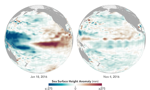
One year ago, the central and eastern parts of the tropical Pacific Ocean were pulsing with heat, a result of one of the most intense El Niño events on record. One year later, La Niña has been relatively quiet, and she does not seem to be staying for long.
La Niña is the cool sister pattern to El Niño. While El Niño knocks down the easterly trade winds and sloshes warm water from the western Pacific to the Americas, La Niña pulls up cool water from the depths of the eastern Pacific, energizes the easterlies, and pushes the warm water back toward Asia. Regions that often get drenched with rain and snow during El Niño often go dry during La Niña events, and vice versa, as atmospheric circulation and jet streams shift with the changing heat and moisture supply from the vast Pacific Ocean.
The maps above compare sea surface height anomalies in the Pacific Ocean as observed by NASA scientists on November 4, 2016, near the peak of the current La Niña, and on January 18, 2016, near the peak of last winter’s El Niño. The measurements were made by altimeters on the Jason-2 and Jason-3 satellites, and show averaged sea surface height anomalies. Shades of red indicate areas where the ocean stood higher than the normal sea level; surface height is a good proxy for temperatures because warmer water expands to fill more volume. Shades of blue show where sea level and temperatures were lower than average (water contraction). Normal sea-level conditions appear in white.
In a report issued in December 2016, the NOAA Climate Prediction Center described the latest La Niña as “weak” and likely changing to neutral conditions in early 2017. La Niña conditions—with surface water temperatures at least 0.5° Celsius below normal in the central and eastern Pacific (the Niño 3.4 region from 170° to 120° West longitude)—began to surface in July and August 2016. During last year’s El Niño, surface water temperatures were as much as 2.5°C above the 1981-2010 norm. During the current La Niña, temperatures have not dropped more than 1 degree below normal.
“Last year’s Niño was huge in area, duration, and magnitude,” said Bill Patzert, a climatologist at NASA’s Jet Propulsion Laboratory. “My take is that because it lasted so long and covered such a large area, it damped the return of strong trade winds needed for a healthy Niña. Note the strong positive heat content north of the equator—the entire tropical Pacific between Central America and Hawaii—that lingered into the fall.”
Muted La Niña Follows Potent El Niño, NASA's Earth Observatory, Jan 6, 2017


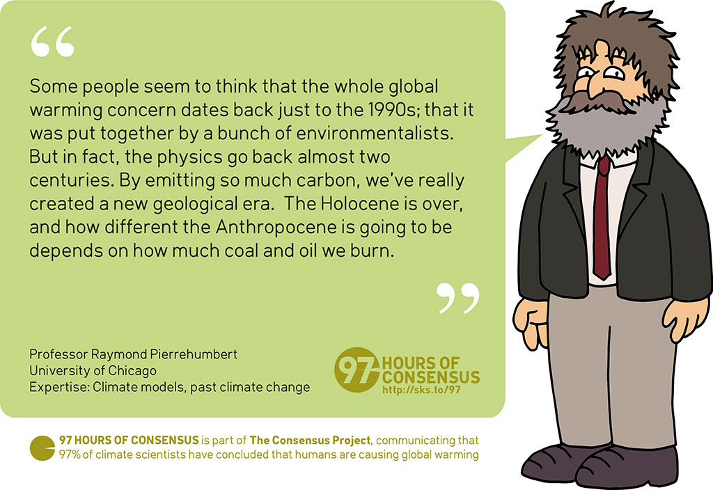
Raymond Pierrehumbert's bio page & Quote source
High resolution JPEG (1024 pixels wide)
Posted by John Hartz on Sunday, 8 January, 2017
 |
The Skeptical Science website by Skeptical Science is licensed under a Creative Commons Attribution 3.0 Unported License. |